
Other government regulations come into play when examining the land yield (i.e. number of buildable lots) that can be generated at a marina site. They include zoning, zoning overlays, flood zone classification, state laws, local laws and local governmental attitude toward development.
Zoning ordinances affect marina land in two principal ways. First, they limit certain types of uses. Most common exclusions are dry stack storage and dry storage (storing boats on the land). They can go further than that by limiting residential development or curtailing it altogether. Of particular importance are keywords that describe how residential development will be viewed. If you see something that says “residential development is discouraged” or “low-intensity development”, those are big, red flags that obtaining a good development yield will be very difficult.
 Zoning overlays are easy to overlook but they can play a key role. For instance, in Maryland the LDA zoning overlay (Limited Development Area) limits lot coverage to 15 percent. That includes the building footprint excluding porches, roads, driveways, sidewalks, enclosed porches and walkways. One of the key purposes of this is to limit water runoff.
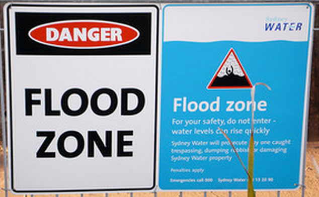
Flood zone classification of marinas typically receive “A” or “X” classifications. The main effect flood zone has on marina land is that any livable area must be elevated above the level of the 100-year flood line and livable area is not permitted below this line (i.e. you can use it for vehicular storage). Roads must be elevated to the level of the 100-year flood as well, so if an access road exists that is below this level, it will need filling to be elevated above this mark.
Many states along oceans have implemented laws that limit marina land development. New Jersey has CAFRA. Maryland has the Critical Area Overlay District (CAOD). Essentially, what these regulations do is limit development within a certain distance from the water. In Maryland, the jurisdictional limit is 1,000 feet. They also typically impose a buffer area that prevents all development. In Maryland, this was 100 feet, but in April it was increased to 200 feet from the water’s edge. CAOD prevents the cutting of trees within the 1,000 foot buffer so if a marina site has them in the buffer, they cannot be cut to give new homeowners unobstructed views of the water.
Local laws can have even more of an impact on development than all the above put together. For instance, the Rock Hall Maryland Flood Ordinance Section 5.3 limits fill to only 600 cubic yards per parcel/lot. Considering you need to raise the road up to the 100-year flood level, that may not even be enough to finish a road, let alone anything else on the property! This is one example of local laws piggybacking on the flood zone classification from FEMA and it being more restrictive than all other governmental regulations combined!
And then there is the issue of minor versus major subdivision, which in Maryland has a threshold of five per lot. I won’t go into it except to say that there is typically a higher level of documentation required for submission of a major subdivision than a minor one (the costs for the studies to be prepared for approval submission are also higher) and the level of local resident resistance will be greater for a major subdivision than a minor one.
Which brings me to the final topic in this post. It can be difficult to quantify and support the level of government resistance to development. Everyone may know about it, but getting support is difficult. You need the cooperation of planning board personnel to pull submissions and help with pointing you in the direction of lawsuits that were present (and frequently dropped prior to final resolution). Can you get permission to subdivide the site at all? If you wanted to subdivide a marina site into, say, 15 lots and there are no 15 lot subdivisions in town… well, that’s a pretty easy point to make. When there are 15 lot subdivisions but the government doesn’t want any more, that’s a harder case to prove.
So this concludes the fact-based portion of developing marina land. The last part of this series will bring it all together and present a set of tests that should be used when determining if marina land has development potential. The value of the marina land depends on them.
The final part of this series will explore what happens to the extra land at a marina: is it surplus land or excess land?